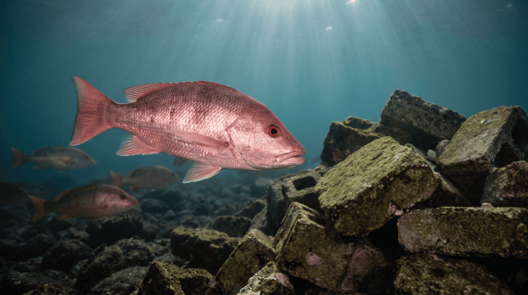
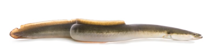
There’s one river left in the lower 48 states that still holds a native population of river-dwelling Arctic grayling. Michigan’s are gone. This is it.
Montana Fish, Wildlife & Parks says so directly on its grayling page, and that fact reorganizes how you should think about the whole drainage. It means the upper river isn’t just pretty water with trout in it. It’s the last address of something.
The shape of it
FWP puts the river at 115 miles, running from Skinner Lake at 7,340 feet in the Beaverhead Mountains down to 4,600 feet near Twin Bridges, draining 2,476 square miles. It meets the Beaverhead near Twin Bridges and the two of them form the Jefferson.
It changes character twice on the way down. The upper river through the Big Hole Valley is slow, willowy meadow water — this is the grayling and brook trout stretch. Through the canyon between Divide and Melrose it turns into boulder-strewn pocket water where rainbows dominate. Below Melrose it spreads out and braids through cottonwood bottoms with brown trout as the main event.
Three rivers wearing one name. Advice about “the Big Hole” that doesn’t say which section is advice about a river somebody else fished.
The numbers, and one that doesn’t look good
FWP has monitored the Melrose section every year since 1969, which is an unusually long record for a freestone river, and it also monitors sections at Jerry Creek, Hogback and Pennington.
FWP’s own “ideal” range at Melrose is 1,198 to 1,698 trout per mile; at Hogback, 1,064 to 1,520. Those are the middle fifty percent of historical estimates, not a target anybody set.
The 2024 spring estimates came in well under that. Melrose: 192 rainbows per mile and 506 browns, against long-term averages of 488 and 908. Hogback: 263 rainbows and 722 browns, against 473 and 920. Both were improvements on 2023.
FWP’s drainage plan states that brown trout abundance has been at all-time lows at most sites, declining across roughly seven consecutive years, and that the cause has not been resolved. Nobody has a confident answer yet. It’s an open question that a state agency, a university and a watershed committee are all working on.
That’s worth sitting with. The river fishes well, and it also has a trend in it that nobody has explained.
The grayling and the agreement
Arctic grayling in the Big Hole are a Montana Species of Special Concern, and the conservation work around them is one of the more interesting things happening on any American river.
Since 2009 a voluntary Candidate Conservation Agreement with Assurances has run in the upper drainage above Dickie Bridge — FWP, the U.S. Fish and Wildlife Service, DNRC and NRCS working with private landowners on flows, riparian habitat and irrigation infrastructure. The Big Hole Watershed Committee reports 31 enrolled landowners covering 164,562 private acres plus state lease ground as of 2025. FWP’s drainage plan cites roughly a 162 percent increase in genetic monitoring population estimates since the program began.
The federal listing question is still moving. USFWS found listing not warranted in 2014 and again in July 2020. A 2024 court decision vacated that and ordered a new determination, and the deadline has since been extended — the current decision date is February 2027.
Grayling are released. Know what one looks like before you go: that enormous sail of a dorsal fin is unmistakable once you’ve seen it, and a grayling mistaken for a whitefish in low light is an entirely avoidable problem. Check the current Montana regulations for the drainage before you fish.
The drought plan is the thing you have to plan around
This is the part that most affects whether your trip happens.
The Big Hole is a freestone river in a valley with heavy flood irrigation, and in a dry year the lower flows and the higher temperatures arrive together. In 1997 the Big Hole Watershed Committee adopted a Drought Management Plan built on shared sacrifice — the drainage is divided into five management sections, each with its own flow and temperature triggers. Irrigators cut back voluntarily; FWP imposes restrictions when thresholds are crossed.
Two kinds of restriction. Hoot-owl closes fishing from 2 p.m. to midnight, triggered generally when maximum daily water temperature hits 73°F for three consecutive days. Full closure shuts a section entirely, 24 hours, and on the Big Hole those are keyed to flow — around 20 cfs in the uppermost section, 100 cfs at the bottom.
In 2026, the entire river below Saginaw Bridge went hoot-owl on July 29. Sections 1 and 5 went to full drought closure on August 13. Hoot-owl on sections 2 through 4 was lifted on August 18.
Which is exactly why you don’t plan off a number in an article. Check FWP’s waterbody closures page the morning you leave. Status changes week to week and the sections are managed separately, so “the Big Hole is closed” and “the Big Hole is open” can both be true on the same day.
Regulations worth knowing before you rig up
The rules on this river have gotten tight, and they’re not the ones you’ll find in older articles. Under the 2026 Montana regulations, everything from Dickie Bridge down to the mouth is open April 1 through September 30 and catch-and-release only. From Dickie Bridge to Brownes Bridge it’s artificial lures only on top of that. Above Dickie Bridge you can keep five trout combined, and grayling go back anywhere on the river.
Those date from 2022 and regulations get revised, so go by the current booklet for the drainage, not this paragraph.
Access and the salmonfly problem
There’s public access along most of the river — Fishtrap, Dickie Bridge, Jerry Creek, Dewey, Divide, Powerhouse, Maiden Rock, Salmon Fly at Melrose, Glen, Notch Bottom, Pennington. Plenty of doors.
And then there’s the first two weeks of June, when the salmonflies come off and the entire fly-fishing population of southwest Montana arrives at the same time. They run size 4 to 8, the largest insect on the river, and the fish eat them with enthusiasm. It’s genuinely as good as advertised, and you will not be alone.
The rest of the calendar gets less attention and is frequently better fishing on emptier water. There are Skwalas in early April, March Browns, and Mother’s Day caddis from mid-April. Golden stones run mid-June into July and PMDs late June through July. Hoppers start in late July, spruce moths show up in August above Melrose, and Tricos come late summer below Divide. Blue-winged olives bookend the season.
What to actually take from this
If you’re driving to the Big Hole, check the closure page that morning and figure out which of the three rivers you’re actually fishing.
And if you end up in the upper meadow water and something with an impossible dorsal fin comes up through the surface at your dry fly, take a second to look at it properly before it goes back. No other river in the lower 48 still has that fish as a native.
FIELD OBJECT
This one should leave the page.
The article is the long version. These are the pieces worth carrying into the next trip.
The 30-second version
The Big Hole holds the last native river grayling in the lower 48. It also has a brown trout decline nobody's explained yet, and a drought plan that can decide your season for you.
What to watch
- The shape of it
- The numbers, and one that doesn't look good
- The grayling and the agreement
- The drought plan is the thing you have to plan around
Field card
- The shape of it
- The numbers, and one that doesn't look good
- The grayling and the agreement
- The drought plan is the thing you have to plan around
- Regulations worth knowing before you rig up
RIGHT TOOL, NEXT
Field Sense Navigator
Take the article’s water or access question into a place-specific conditions and route check.