A river can lose water to a pump without anybody ever putting a pipe in the river.
FIELD PLATE · WATERSHED
Water arrives carrying whatever it crossed.
Groundwater and streams are often connected. In a lot of watersheds, groundwater is what keeps a creek running through the dry stretch, and pumping from an aquifer can cut that contribution or pull water away from the stream. The catch is timing — the effect may show up later instead of right away.
So when a creek is down to a trickle between gravel bars that were underwater in June and there’s no obvious drought warning to explain it, that’s a fair question and a hard one to answer from the bank. The cause can be underground, and the response can take years.
How a well gets to a stream
Once snowmelt and rain runoff fade, many streams keep flowing because groundwater seeps into the channel. That’s baseflow. In a drought or late summer it can be much of what’s left, and because groundwater tends to hold a fairly stable temperature, it can also help make cold-water refuge in some systems. A stream doesn’t need a visible spring for groundwater to be doing the work.
A pumping well lowers the groundwater level around it. If that pumping is connected to a nearby stream, some of the pumped water is effectively water that would have discharged to the stream, or water leaking out of the stream faster than it otherwise would. How big that effect is and when it shows up depends on geology, distance, pumping rate, aquifer properties, streambed conditions and other wells nearby. “The well is miles away” doesn’t settle it.
USGS research shows streamflow depletion from pumping can continue after the pumping itself changes and can play out over long time scales, because the aquifer stores the response and releases it slowly. A low-flow problem this summer may reflect water-use decisions from years back, and shutting a well off today won’t necessarily undo it tomorrow. The watershed remembers underground longer than anybody remembers the decision.
It’s tempting to picture a simple radius where close wells matter and far ones don’t. Real aquifers aren’t that tidy. Geology passes pressure unevenly, layers connect in one spot and separate in another, several wells overlap, and a stream can gain water in one stretch and lose it in the next. That’s why groundwater models need aquifer properties, pumping history, recharge, stream geometry and observations from wells and gauges, not just map distance. The models are still uncertain. They’re still more useful than pretending the connection stops at a property line.
What the fish lose
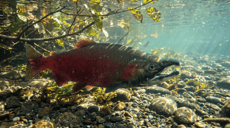
Less water isn’t just shallower water. Low flow can shrink habitat, break connections between pools, raise temperature, concentrate pollutants, cut dilution and make barriers harder to pass. The biology depends on the species and the stream, but the physical part is simple: less water leaves less room for every other thing a fish needs. In a coldwater fishery, losing groundwater can hit twice, taking flow and cool water at the same time.
Not every groundwater input is cold enough to be a real refuge, and not every cold patch is big. Where groundwater does come in cool and steady, though, a spring, a seep or a groundwater-fed tributary can be what gets fish through a hot stretch — the kind of spot you notice when the water around your ankles suddenly changes temperature. Pumping can change where that refuge exists and whether fish can reach it, while the channel looks almost the same from the road. Where Do Trout Go When the Cold Water Shrinks? picks this up from the trout’s side.
Management has to treat connected water as connected
Wells supply drinking water, irrigation and industry, and the people using them live there. The question was never whether pumping should be zero. It’s how much, from where and when, while still meeting streamflow and habitat goals, and that takes hydrology, monitoring, water rights, community needs and planning that looks past one season.
It gets harder when law or management treats connected groundwater and surface water as separate. Then the river is being asked to obey a boundary the aquifer doesn’t recognize. Integrated management uses models and observations to estimate what a withdrawal does to streams and other users over time, whatever label ends up on the permit. The models are imperfect. Ignoring the connection isn’t more accurate.
Monitoring needs both halves. Stream gauges show what the river is doing, observation wells show groundwater levels, and temperature monitoring, spring measurements, pumping records and climate data fill in more. Long records matter because drought, wet years, land-use changes and pumping changes blur together otherwise. A one-day low-flow reading describes that day. It can’t name the cause by itself.
Recharge is the other side of the ledger. Aquifers refill when water soaks in from precipitation, streams, irrigation, managed recharge or other sources, at a pace set by climate, geology, soils, land cover and how fast water gets used or routed away. Pavement can cut infiltration in one place while a stormwater basin or recharge project adds it somewhere else, and irrigation can add recharge in one basin while contributing to water-quality problems in another. Good planning compares withdrawals against the recharge and streamflow relationships that actually exist on that ground.
The hardest fight is usually about timing. A growing community can have enough water on an annual spreadsheet and still create a low-flow problem in exactly the season fish need water most, since irrigation demand often peaks in the same hot stretch a stream has the least to spare. Seasonal management, conservation, recharge, storage and where the wells go matter as much as the yearly totals everybody likes to quote.
Fish have to get through August. Nobody’s ever caught one living in an annual average.
What you can tell from the bank (not much, honestly)
You can’t diagnose an aquifer by staring at a low creek. What you can do is notice when a question needs real hydrology instead of a story that fits what you can see. A low creek and a new subdivision showing up around the same time don’t prove one caused the other.
If a spring-fed reach loses flow in dry years, look at official stream gauges, groundwater reports, drought conditions and agency studies before blaming the nearest well. If a water proposal involves new pumping, look for whether streamflow depletion and seasonal effects were evaluated. Those documents can read like they were written for other hydrologists, mostly because they were. Search for “streamflow depletion” — if the phrase isn’t in there, that’s a fair thing to ask about, and it’s the measured-before-blamed standard Stewardship holds everything to.
Snowpack, rain, dam releases and drought are the obvious lines in a river’s water budget. Groundwater belongs on that list even though you’ll never see it from the bank. Managing the channel and ignoring the water under and beside it is fishing half the rig.